


A blue revolution involves the emergence of aquaculture to cultivate an increase in the production of fish and marine products. India’s fisheries sector is poised for just such an expansion, with promising potential to increase fish production from ponds and tanks, lakes and reservoirs, rivers, lagoons, estuaries and more.
Only 60% of India’s aquaculture resources are currently being used for cultivation. The remaining 40% require new site selections for brackish water culture, cage culture and reservoir fishery culture, which leads to several challenges for technical authorities working on these sites.
Another obstacle is the decentralized database for fisheries, which poses several problems for decision makers and leads to non-optimal production, reducing ROI and commercial profits for aquaculture organizations.
Stakeholders at the central and state levels require data management, analytics and business intelligence in their daily operations to centralize database information and enable the sustainable management of fisheries.
Hexagon’s solutions aim to provide authorities with tools to help them achieve these goals. The robust workflows and smart solutions will tightly integrate statistical data with a GIS-based application while preserving data integrity and overall system performance among hundreds of simultaneous users in fishery offices and cooperatives.
Find more details of Hexagon’s fishery management solution here: ERDAS IMAGINE, GeoMedia Desktop, GeoMedia WebMap, M.App Enterprise, ERDAS APOLLO
Advantages of our solutions
Hexagon’s Geospatial division is a one-stop shop for the needs of fishery operations, from survey equipment to software solutions to help with implementation and maintenance. We’re also a proven leader in remote sensing, experts at processing high-resolution satellite imagery, converting raw data into intelligent data, spatial modeling and 3D visualization.
You can share common GIS data across all platforms — desktop, web, mobile and cloud — with fully integrated business workflows for planning, design, implementation and maintenance. The open database and native capabilities mean you’ll get high-level decision support and predictive modeling without sacrificing speed or performance.
With sophisticated privilege settings, scalability, a low total cost of ownership and the ability to leverage data in a number of business processes, you’ll gain map-based dashboards to visualize accurate and timely statistical information without worrying about limitations.
Potential applications
Surveying: With Hexagon’s solutions, you can accurately measure the area of an inland reservoir, lake or other body of water that has the potential for fish culture. Precise geospatial survey data on the water, harbors and surrounding villages can guide aquaculture decisions.
Mapping: Using Hexagon’s geospatial software, you can map for change detection in newly constructed ponds or monitor ponds not currently engaged in fish production in an area of interest. You can also identify sites suitable for new ponds using satellite image processing via artificial intelligence and machine learning analysis.
High-resolution satellite data processing, geo-referencing and feature extraction of bodies of water aids in classification. Features are processed at coordinate level, attribute level and logical level, then integrated into the GIS system so you can keep an eye on brackish bodies of water, reservoirs and major and minor fish landing centers.
Core GIS framework: Hexagon offers a framework for gathering, managing and analyzing data. Our GIS integrates many types of data, analyzes spatial location and organizes layers of information into visualizations using maps and 3D scenes.
A fishery using Hexagon technology has the capability to set up standard statistical data input with taxonomical nomenclature for easy use. Complex data querying and analysis are possible, along with change detection algorithms to track trends and patterns.
Modeling functionality allows you to explore potential site suitability for brackish water culture or reservoirs and ponds for freshwater fish culture. With desktop, web and mobile GIS applications, you can work and report across platforms with various web and mobile applications like:
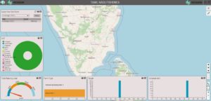
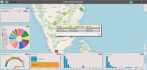
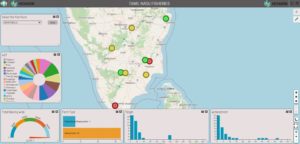
- Fishery census with map-based dashboards
- Catch assessment of marine fisheries
- Catch assessment of inland fisheries
- Integrated GIS-based system for fish e-marketing and e-trading facilities
Hexagon’s core GIS system covers the entire fisheries sector by making all business data available throughout an organization. This not only ensures the quality of the data, but it also provides greater interoperability with other systems and supports industry standards for data storage.
By transforming raw data into useful information to support managerial decision-making, Hexagon supports fisheries throughout the entire business cycle — from site selection to analysis and reporting on water body yields.
There are plenty of fish in the sea, as the saying goes, but with Hexagon’s geospatial solutions to optimize fishery operations, there can be even more!
