


What comes to mind when you hear “geospatial technology?” You probably think about remote sensing, surveying, routing, or Geographic Information Systems. Many of these technologies and capabilities are staples in urban area development and processes. But what about their recreational uses for the outdoors?
There is so much waiting to be discovered on how utilizing geospatial technology can improve outdoor experiences. Matthias Baur, a solution engineer for Hexagon’s Geospatial division based in Germany, recently found this out firsthand.
When he’s away from his PC, Matthias is an enthusiastic outdoor athlete whose interests include cycling and marathon running. Earlier this year, he took on an experiment: crossing the Alps from north to south by bicycle.
“Two years ago, I hiked this tour in eight days, and this year, I wanted to see if it’s possible to do this tour in less than a day and if I can cover such a long distance by bike,” he said. “Because I love the mountains and spend so much time there, it was the perfect challenge for me to cross them by bike this year.”
Key facts about Matthias’ Route through the Alps:
- Approximately 400km
- Over 6000m in ascent and descent
- Crossing three countries with three different climate zones (Germany, Austria, and Italy)
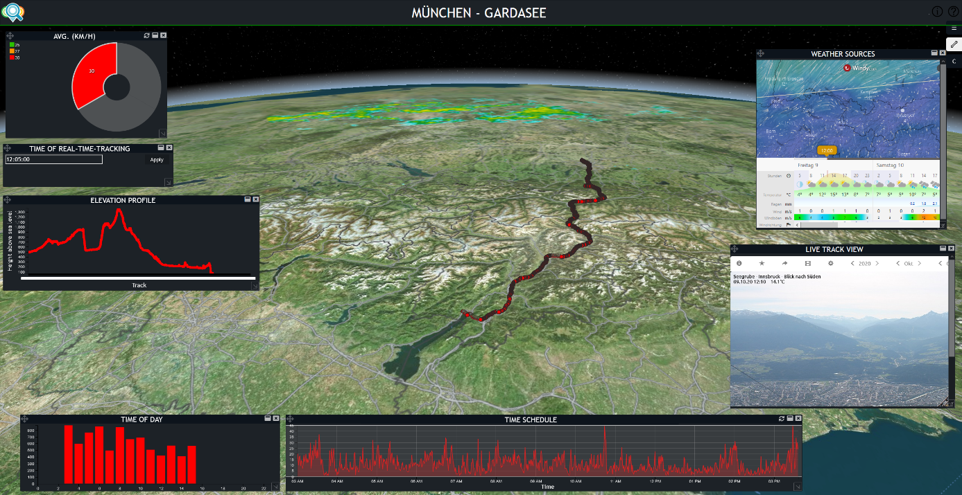
Bringing Situational Awareness to the Alps with M.App Enterprise and LuciadRIA
Planning the trip was crucial to the success of Matthias’ experiment, and many factors needed to be considered during the planning process.
It was important for him to understand the terrain of the route, the navigation, and the current and forecasted weather in the different regions he would pass through. He also wanted to enable live tracking along his journey in case of possible emergencies.
Usually, gathering this information requires separate applications to handle all of the different data sources and sensors, which can be a bit challenging to keep track of. Instead, Matthias used Hexagon’s Smart Monitoring Solution based on M.App Enterprise and LuciadRIA.
The solution features an interactive 3D-View based on LuciadRIA that enables an easy integration of a wide range of sensors and data sources. This can be used to increase situational awareness, safety, and, most importantly, fun for any outdoor adventurer.
According to the nature blog The Vertical Adventurer, “Situational awareness, in terms of outdoor adventures, is your perception of environmental elements in relation to you and your occupation of the surrounding space.”
 During the planning, Matthias focused on understanding the terrain along the route which was enabled by the 3D View. In addition, he concentrated on the ability to monitor the weather conditions along the route in real time. He accomplished this by connecting to weather data sources including WMS-Services or webcams in the different regions.
Real-time wind data or air pressure sensors from various stations along the route completed the necessary picture.
“Most of all, I benefited from the fact that I could keep an eye on the weather at all times and that I had route navigation,” he said. “I also didn’t have to worry about emergencies because I had real-time tracking, which meant that my family and friends could follow me virtually.”
While nature can impact the safety and enjoyment of any outdoor adventure, understanding the potential for hazards like storms is essential for staying safe in areas with rapidly changing weather conditions like in the alps.
By accessing Hexagon’s Smart Monitoring Solution from his smartphone, Matthias was able to improve safety and certainty along the route of his adventure while shortening his planning time.
Reaching the End of the Journey
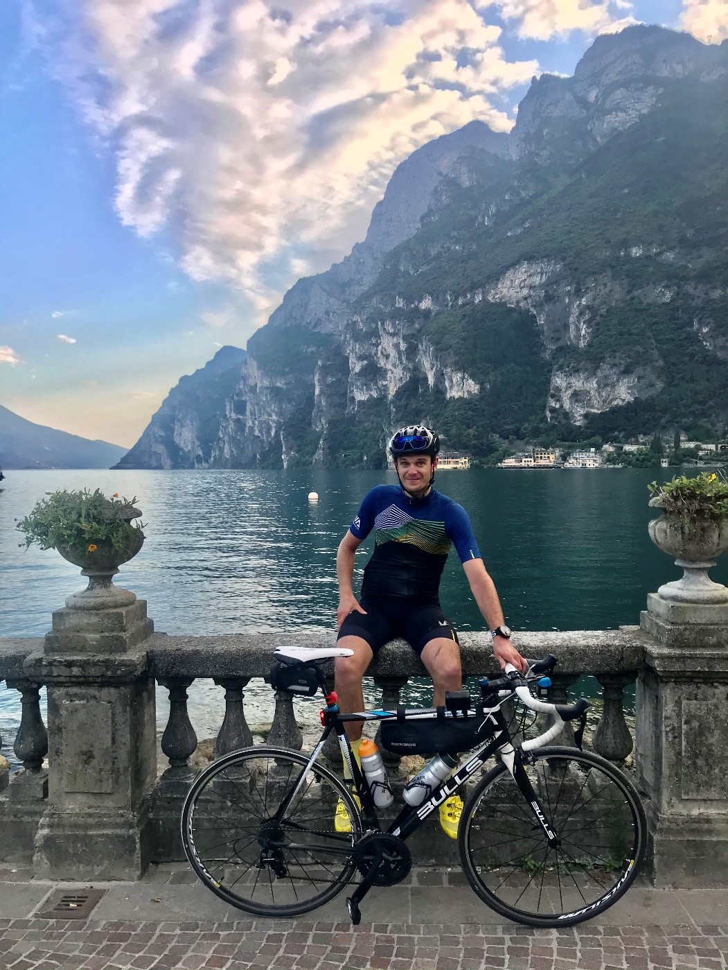
In the end, it took Matthias less than 15 hours to cross the Alps by bike from Munich (Germany) to Riva del Garda (Italy), and he arrived safely without any incidents.
“After I finished the tour, I felt very happy and proud of myself, but I was also quite tired and my legs were quite exhausted,” he said. “Most of all, I felt hungry, which I could satisfy with a large Italian pizza.”
Matthias said that if you know what to expect along your route, you can prepare better, making every trip a great and successful adventure.
Ready to use Smart Monitoring on your next adventure? Start with our webinar on how you can create your own solution.
