


Students of the Arab Academy of Science, Technology, and Maritime Transport in Cairo, Egypt, successfully took part in ERDAS IMAGINE remote sensing courses provided by Brilliant Remote Sensing Labs (BRS-Labs) during their fall 2018 semester.
BRS-Labs is a United Arab Emirates-based company that offers a full online educational program in the field of remote sensing and satellite image processing that includes education, evaluation, testing, and certification.
The faculty at the Arab Academy of Science, Technology, and Maritime Transport (AASTMT) taught more than 60 undergraduates from computer science, information systems, and software engineering backgrounds with the BRS-Labs curriculum, leading them to complete a “Remote Sensing and Satellite Image Processing” study as part of the academy’s Professional Training subject curriculum.
Professor Dr. Abo Rizka, the Dean of the faculty of Computer Science at AASTMT, is keen of studying the needs of the market and updating the curricula with the most advanced technologies, such as that of remote sensing and satellite image processing.
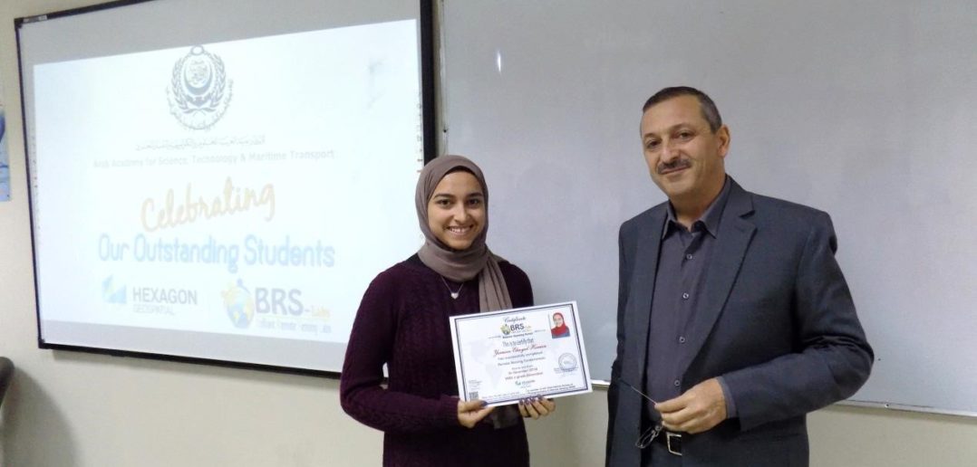
For Yasmien Elsayed, one of the program’s top students, those advanced technologies made an impression.
“During our study, our lab at the AASTMT has been equipped with the most advanced software, satellite images, and training materials,” she said. “Our curriculum included an overview of space science and remote sensing, satellite image analysis and processing steps, digitizing and annotation, advanced classification and change detection, map production, and many other topics.”
BRS-Labs Bases In-Depth Curriculum on Hexagon Software
BRS-Labs’ education program, called Remote Sensing Portal, offers three levels of certification. The first level, Remote Sensing Specialist, was covered during the study for the AASTMT students. The next levels of certification are Remote Sensing Professional and Remote Sensing Solution Developer.
The curriculum for the three certificate programs is based on the latest version of Hexagon’s remote sensing software, ERDAS IMAGINE, and it is designed to help universities develop and integrate their curriculum with new geoinformatics and geomatics technologies. BRS-Labs’ program provides free software educational licenses for students, professors, and professionals around the world.
Geoinformatics is the science and the technology which develops and uses information science infrastructure to address problems in the fields of geography, cartography, geosciences, GIS, geology, agriculture, urban planning, and many related branches of science and engineering.
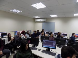
The AASTMT students described their experience completing final projects in map production using ERDAS IMAGINE remote sensing software as successful and rewarding. Many had never used the software before and were excited to sharpen their skills.
For Elsayed, learning new skills within the program expanded her possibilities for the future.
“As a student, this course opened my eyes to a new career I never thought I could pursue after I finish my studies,” she said. “It gave me knowledge and understanding of things that I didn’t know before how they worked. I highly recommend this course to always be given to students.”
Edge-Pro For Information Systems, a Hexagon partner in Egypt, has offered AASTMT a discounted option for Hexagon’s Desktop Educational Program. The software in the program is to be used and studied freely by the students, allowing them to continue accessing ERDAS IMAGINE, but also granting access to tools for GIS management, photogrammetry, and data management and delivery.
Professor Dr. Rizka has also confirmed that the academy intends to continue with similar BRS-Labs programs in 2019 and beyond. Learn more about the Educational Programs Hexagon has to offer on our website.
About the Author: Ayman Salem
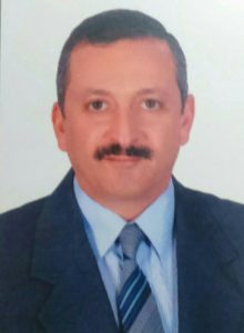
Ayman Salem is the Executive Director of Brilliant Remote Sensing Labs Company, a Developing Education Partner of Hexagon’s Geospatial division. He is also the Founder of The Remote Sensing Portal, a Sustaining member at ISPRS, and an ERDAS IMAGINE Authorized Instructor. He developed a remote sensing curriculum that consists of 16 short courses based on ERDAS IMAGINE software. He is conducting weekly online remote sensing exams and issuing certificates through the Remote Sensing Portal. He is also supporting the brand awareness of ERDAS IMAGINE.
