If you can’t map it, you can’t manage it.
This fact has become clearer than ever as the COVID-19 pandemic has spread around the globe. Government officials and health care workers need to know what they’re up against, and that includes location-based intelligence like hotspots where new cases of the virus are appearing most rapidly.
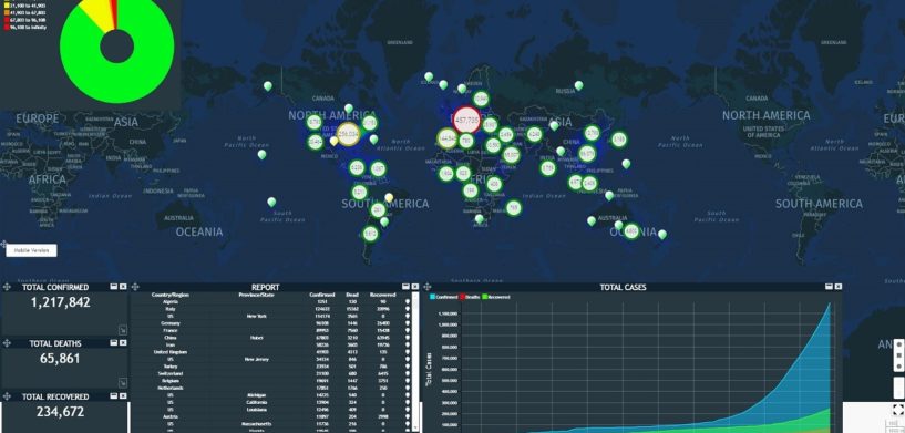
Organizations at the local, regional, and national levels have turned to geospatial technology to help manage their response to COVID-19. Hexagon’s Geospatial division is assisting authorities by providing location intelligence and situational awareness tools that help them visualize, analyze, and communicate COVID-19 issues, including in real time.
Among the solutions employed in the fight against the virus are dashboards and common operating pictures featuring 2D and 3D static and dynamic data and apps and portals for better data collection and information sharing.
Forward-thinking governments are using location intelligence to crowdsource citizen data on supply shortages and social distancing violations, then communicating back the information they gather. They’re also partnering with retailers to provide citizens with maps displaying the availability of essential items.
When Disaster Strikes
But COVID-19 isn’t the only application for these technologies. In all types of humanitarian crises, the deployment of location-based data can be relevant to every phase of disaster management, including prevention, mitigation, preparedness, response, and relief.
Image mapping can help identify possible risks through automated change detection. This kind of proactive management protects human lives, prevents damage to critical infrastructure, and saves money by allowing officials to take action before disaster strikes.
Meanwhile, the ability to rapidly evaluate an ever-changing situation, like a tornado or a wildfire, means authorities can be confident in their decisions even in challenging conditions because they have the latest data at their disposal.
Quickly organizing and distributing that critical data to first responders and relief agencies allows those agencies to better plan and prioritize their work, and in the event of a flood or landslide, collecting and sharing helpful information with the affected community keeps citizens safer.
In the end, that’s what it’s all about. Saving lives — and making lives better — is the entire purpose of technology. Want to learn more about how Hexagon’s Geospatial division is leveraging our cutting-edge solutions to do all this and more when crises arise? Watch our webinar today!


