


Keeping current on the location and status of assets within large organizations is a challenging task. The increasing availability of both airborne and terrestrial point clouds combined with the ability to view them side by side with existing GIS data in a 3D view presents new opportunities for rapid, intuitive, and accurate asset management.
Let’s briefly address the enablers and then break it down and look at each aspect. GeoMedia is a powerful, flexible GIS management platform that lets you aggregate data from a variety of sources and analyze them in unison to extract clear, actionable information. It provides simultaneous access to geospatial data in almost any form, uniting them in a single map view for efficient processing, analysis, presentation, and sharing. GeoMedia data access now includes point cloud data, and if you include the GeoMedia 3D extension, you have the makings of an interesting solution for asset management.
With GeoMedia 3D you can leverage an inventory of 3D models and use GIS Attribute Based Symbology (ABS) to replace 2D point symbols with 3D representations to represent the assets in the real world terms.
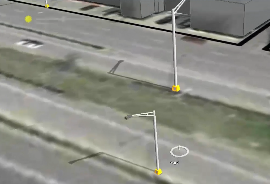
Figure 1. 3D Models Representing Lamp Post Placement
Now let’s bring in the point cloud data. It will overlay the GIS data (note that point cloud data is just another data type in GeoMedia and is treated just as any GIS data would be). We can immediately gain insight into the accuracy of asset placement recorded in the GIS.
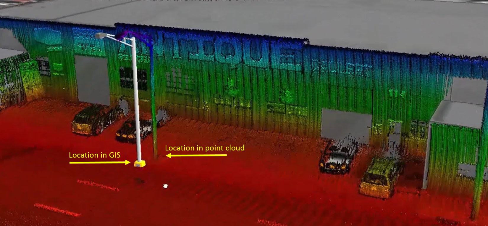
Figure 2. Comparing GIS Lamp Post Location with Newly Captured Point Cloud Data
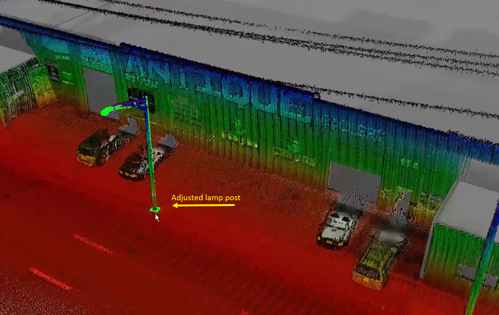
It would not be unusual for asset management systems that have been in operation for some time to have inherent inaccuracies. However, now there’s the ability to quickly verify and correct any deficiencies. With the combined point cloud/GIS data view, it is simple to adjust the GIS feature in the database to line up with the point cloud information.
Let’s recap my earlier statement:
- Rapid – The point cloud data is collected all at once with no specific focus needed on any individual assets. Actual asset selection can be done back in the shop.
- Intuitive – The visual of the point cloud data directly alongside the GIS data represented as 3D models but directly anchored by the 2D GIS coordinate information is as intuitive as you can get.
- Accurate – Three words: point cloud data. We can bring the point cloud data directly into the GIS and work with it. However, this data didn’t need any collection, or translation processes, any of which could introduce accuracy variances.
So far we have discussed location, but the point cloud data is dense enough that we can assess the condition of the assets as well. There’s also an added bonus – the point cloud data could be stored for use at a later date. In the future, the same data used in this example can be used to check the positioning of the road signs on the highway or the condition of guard rails.
Resources:
GIS Point Cloud Integration White Paper
