


WebGIS is a part of a Platform Suite which enables you to deliver information through a web, mobile, or smart solution. With it, you can build and extend customized geospatial apps and solutions with a sophisticated set of developer-focused technologies.
Geospatial Portal Consumer Layout is a simplified, light weight web client application. It provides fundamental functionalities for users consuming spatial data and is constantly developed and improved with new features, maintaining its simplicity and ease of use.
With the 2018 release, we have introduced new useful features in the Consumer Portal layout including:
- Measurements
- Feature Info
- Go to My Location
Measurements
Measurements are now available for users of Consumer Portal layout. The Measurements panel on the right-side of the interface allows you to access tools and select the measurement type needed.
With the new measurement panel, you can measure:
- Distance, including single segments or paths composed of multiple segments.
- Area
- Geographic coordinates of any point.
All measurements in Consumer Portal layout are fast and effortless. Simply select your tool and digitize on-screen. The result is displayed in the Measurement panel.
The measurement tools will automatically change measurement units based on the length or size of the feature you are measuring. For example, measuring a line or route between cities will be measured in kilometers while measuring small objects, such as swimming pool, will result in meters.
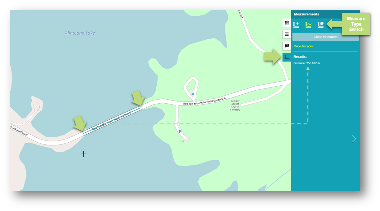
Fig. 1 Line measurements in Consumer Portal layout
Feature Info
You can now display feature information, for any feature portrayed on a map, with just a click. The Feature Info tool retrieves attribute information for all layers under the tapped point if such data is available.
The Feature Info function is invoked through a button conveniently located near the navigation bar. Once active, click on an area or feature you are interested in and a list of query-able layers will be displayed. Select a layer and all the necessary information will be displayed a pop-up window.
Feature Info works for all active layers on the map. In addition, you can switch between layers directly in the Feature Info window by clicking appropriate tabs.
Feature Info can be obtained from the following service types:
- WMS
- WFS
- WMPS
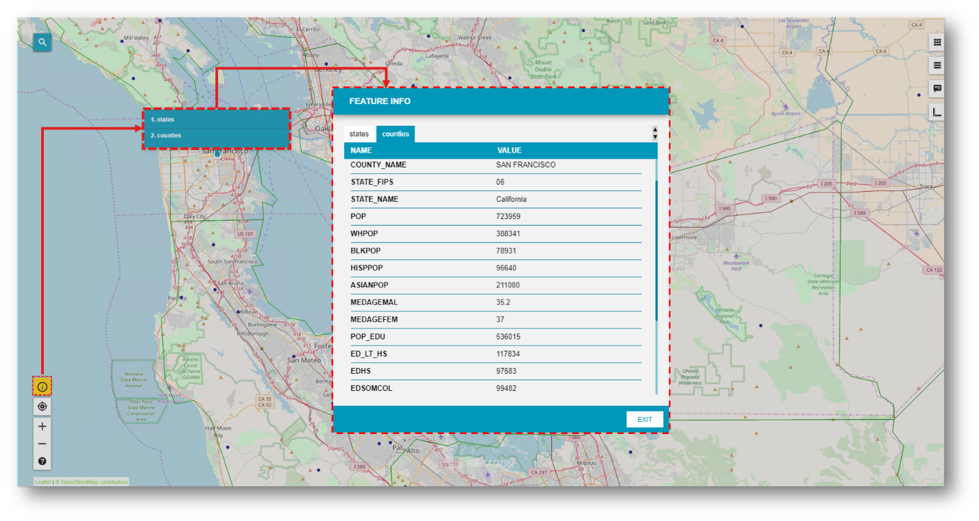
Fig. 2 Feature Info tool and dialog in Consumer Portal layout
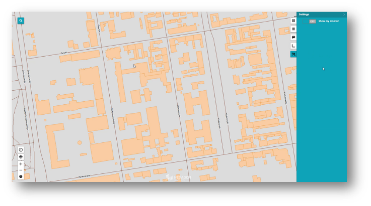
Go to My Location
You can now display the current user location on a map. The user’s location is provided based on GPS position or IP address. Most current mobile devices use GPS location when it’s enabled.
Click the Go to My Location button to zoom the map to the user location. The location is indicated on the map by a small blue dot surrounded by shaded visual cue.
This feature can be disabled on the new Settings tab in the right panel. When the Show My Location option is turned off, the map will zoom to center on the user’s location, but it will not display the position on the map.
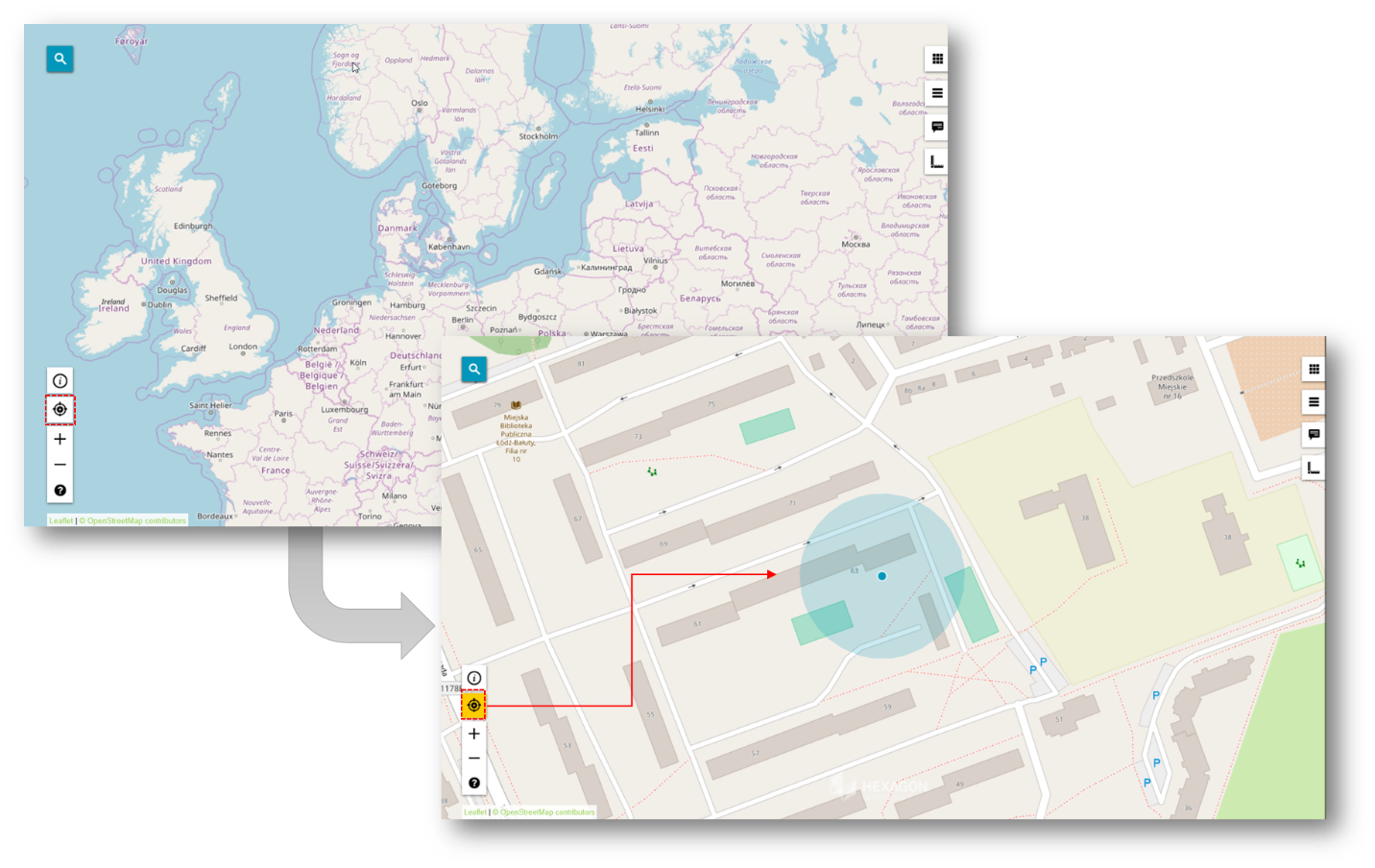
Fig. 3 Go to My Location feature in Consumer Portal layout
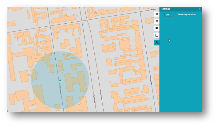
‘Show My Location’ turned on
‘Show My Location’ turned off
