M.App X 2020 delivers 3D display modes, accelerated visualization, and a new user interface.
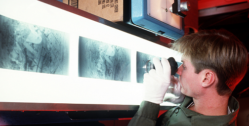
Imagery analysis has come a long way since the days of old when specialists worked in darkened rooms staring at film for eight hours straight and organizing their film into small boxes that resembled shoeboxes. Today, all of the imagery a GIS specialist utilizes can be hosted, organized, and analyzed in the cloud. The creators of M.App X adopted the term “shoebox” for the digital area in which users organize their imagery to pay homage to this dated, yet creative, means of storing film images.
The Shoebox in M.App X 2020 organizes the imagery needed for individual projects. The imagery can be sorted by region, project, application, etc., for review or exploitation based on the analyst’s schedule. Data can be stored and scattered anywhere on a user’s computer or network. Shoebox entries are convenient shortcuts that point to those scattered locations, so performing tasks for particular projects is easy because all the data is at the user’s fingertips, neatly presented in a convenient list within the project’s shoebox. Choose the desired entry and the software pulls all associated data from wherever it happens to be located.
Besides not having to find storage for thousands of physical shoeboxes in order to maintain a sophisticated imagery database, M.App X 2020 delivers many more features that enable faster performance, enhanced image processing, accurate analysis, and confident decision making.
M.App X 2020 was upgraded to use the mapping engine from Hexagon’s LuciadRIA. Now users can easily switch between 2D and 3D operation and display modes. Users will also enjoy improved GPU performance and accelerated imagery visualization and analysis with this upgrade.
“For Defense and Intelligence organizations, the ability to quickly and easily exploit imagery and create imagery-based products is critical to mission success,” said Mladen Stojic, president of Hexagon’s Geospatial division. “With the addition of LuciadRIA, M.App X users can better support mission planning and operations through accelerated imagery visualization and analysis, including in 3D.”
M.App X 2020 also offers an intuitive, redesigned user interface with more efficient use of screen space and personalization. On-screen tools like a floating zoom palette and an interactive rotation tool provide quick access to commonly used functions and smart annotation with rich styling and reporting capabilities. M.App X 2020 also features the ability to simply drag-and-drop datasets and easily download geoprocessing results to the desktop.
The latest version of M.App X builds on geospatial tradecraft creation, common usage, and secure GEOINT data sharing from past releases while offering rich and extensive sensor support for Defense formats such as NITF 2.1. Faster image display in image space, map space, and stereo increases efficiency and reduces analysis time. Extensible geoprocessing is available via Hexagon’s Spatial Modeler Engine.
M.App X 2020 also provides an administrator console for managing user accounts, licenses, and system usage.
To learn more about M.App X 2020, visit our website or join the Hexagon Community to get the latest announcements, meet industry members, and join our geospatial technology discussions.


