


For thousands of years, we have known that the earth is round. In order to flatten a globe’s surface into a plane to make a map, we need map projections. This is a systematic transformation of the latitudes and longitudes of locations from the surface of the globe into locations on a plane. All projections of a sphere on a plane necessarily distort the surface in some way and to some extent.
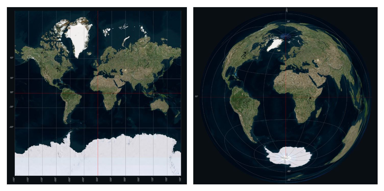
Mercator Projection and Lambert Projection
For instance, the Mercator projection (left image) preserves the shape of countries while distorting the size, especially near the North and South Poles. Greenland is the same size as Africa on this map. For a more accurate view of land area, look at the Lambert projection (right image), which preserves area while distorting shape. South America looks like it has been stretched.
Depending on the purpose of the map, some distortions are acceptable, and others are not; therefore, different map projections exist in order to preserve some properties of the sphere-like body at the expense of other properties.
Developing the Krovak Projection
After WWI and the dissolve of the Habsburg Empire, the newly formed Czechoslovak Republic built its own geodetic and cartographic system. The Conformal Oblique Conic Projection of Czechoslovakia was prepared by Josef Křovák in 1922 for construction of cadastral maps and topographical maps of medium scales for the civil geodetic service of Czechoslovakia.
The Krovak projection has been defined to provide minimum distortion throughout the unequally shaped country. The result is clearly visible when comparing the shape from Czech Republic in the Krovak projection to a regular projection.
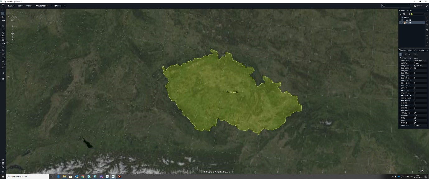
Krovak Projection
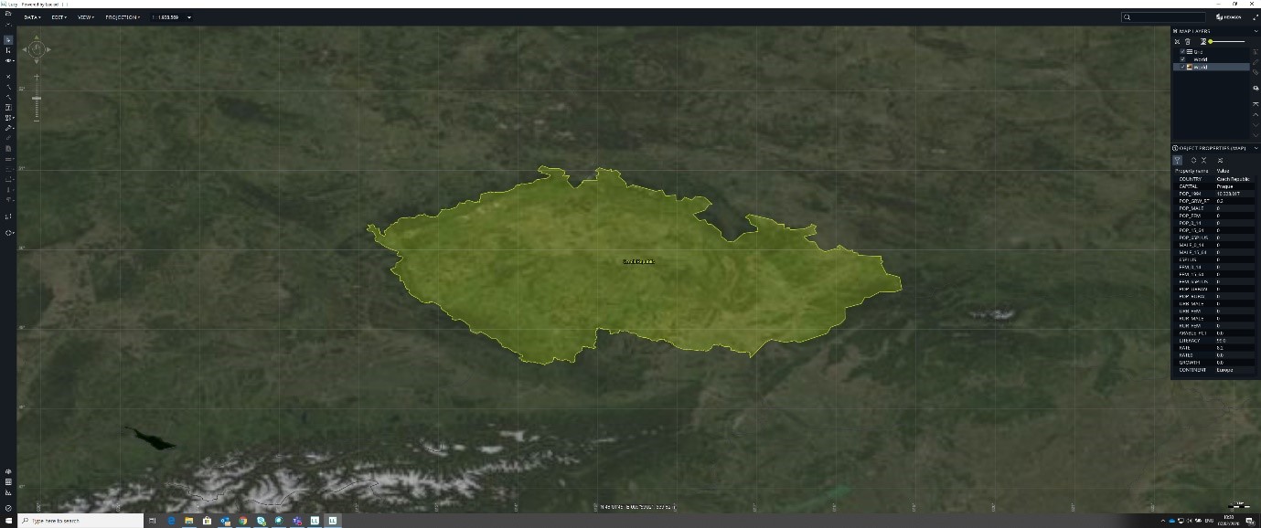
Regular Projection
The Krovak projection is still used as the standard projection in the Czech Republic and Slovakia today. To better support our customers in these countries, LuciadLightspeed 2020.0 and LuciadFusion 2020.0 now support the Krovak projection. With the introduction of this projection, the following additional EPSG codes are available: EPSG:2065, EPSG:5221, EPSG:5513, EPSG:5514, EPSG:8352, and EPSG:8353.
Interested in learning more about supported map projections in the Luciad Portfolio? Read our blog about our flat earth projection.
