


One of the challenges faced by the assessment industry is how to ensure appraised property values are commensurate with the perceived value of a property or conversely, defending a value once it has been estimated. This issue is exacerbated when you apply it to dense high rise properties where there are many similar units readily available for casual comparison.
Every commercial and residential high rise office or living space has measurable characteristics such as age, size, location, and proximity. These can be recorded and published for all to see. Other variables, such as overall condition and specific view, are also important factors that can account for a particular unit’s value being higher or lower than another unit of the same measurable dimensions. The challenge faced by appraisers is how to ensure these “intangibles” are also accounted for in a consistent and equitable manner.
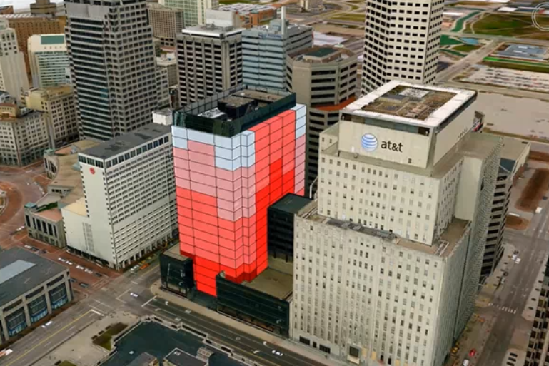
GeoMedia 3D view of high rise office space.
Dynamic 3D visualization of high rise properties with GeoMedia 3D can make it easier to address the variances between what, on paper, appear to be similar units to the casual observer. An appraiser having the 3D visualization available is better able to understand why one unit should be valued in a particular way, based on factors such as view in relation to the surrounding units. These tools can supplement the existing value methodology found in a typical Computer-Assisted Mass Appraisal, or CAMA, system by providing additional justification and support for established values as well as finding missing, incomplete, or incorrect values quickly and easily.
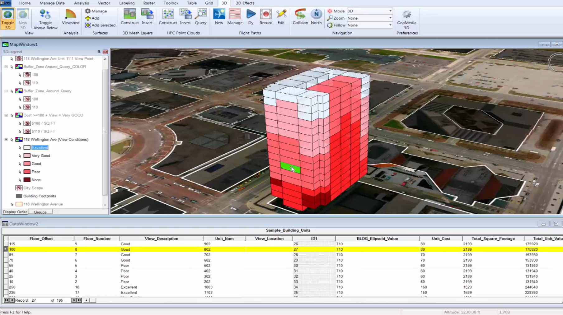
Viewing individual units and associated attributes.
Viewing unit information in 2D, it is difficult to distinguish individual unit features from one floor to the next. GeoMedia 3D, gives you a much more realistic representation of the building, and as a result, the process of viewing, selecting, and reviewing attributions is much more intuitive. With this approach you can easily select each unit and view the attributes. You can visually see the change in value from one unit to the next as you move from floor to floor. When a unit is selected from the list, it is automatically highlighted to reflect the selection giving you an immediate understanding of its actual location.
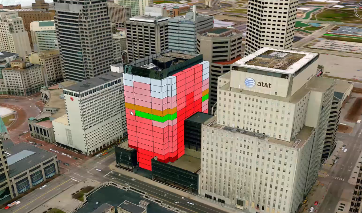
Highlighting the units that meet criteria.
The analytical tools in GeoMedia can display the different rankings for square footage, lease price, and view, with visual indicators to quickly evaluate what’s available. You can also use GeoMedia to create rankings to reflect any of the CAMA attributes, like a Google search, but done analytically. This will enable establishing consistent appraisal values for all the units, quickly finding specific units that meet criteria, and identifying any outliers upon completion.
For more information on this topic watch the High Rise Valuation with GeoMedia 3D video.
