It has become increasingly obvious that our future as a species depends on how we treat the environment. The undeniable truth is that caring for the planet is critically important, and Hexagon’s Geospatial division has made it a key objective, striving to make progress in the area of efficient and environmentally friendly innovation.
In October 2020, the International Energy Agency, a global intergovernmental organization, concluded that the best available solar power schemes now offer “the cheapest source of electricity in history,” according to the BBC.
 And in much of the world, renewable energy sources are already often cheaper than fossil fuels when it comes to building new power stations.
Renewable Energy Production Is Growing
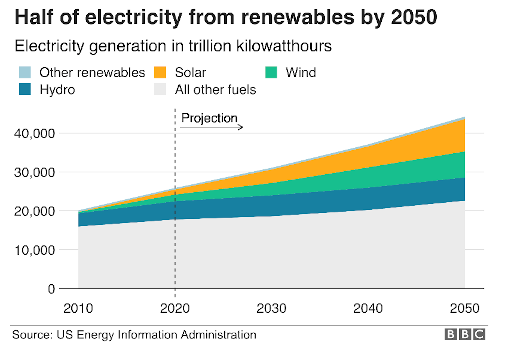
The US Energy Information Administration predicts that energy production from renewables will grow at such a rate that, by 2050, half of all energy produced will come from renewable sources like solar, wind, and hydro.
Hexagon’s solutions enable officials to make smart, data-driven decisions regarding these new energy sources, whether it’s finding the optimal location for wind farms (on land and at sea), guiding energy producers in the placement of electrical towers, or discovering the best locations for solar farms.
Our tools allow decision makers to consider all the variables of a project. And, even more importantly, environmental specialists don’t need expensive training or technical expertise. They can focus on doing what they do best while taking advantage of our user-friendly data management, analysis, and visualization offerings.
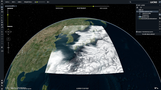
Learning About the Land from Imagery
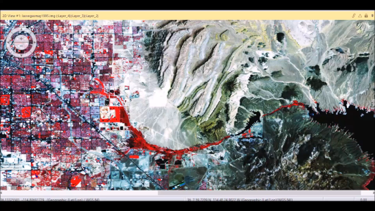
Studying the Earth means necessarily including elements that exist as continuous surfaces, such as vegetation on land. We can use artificial intelligence techniques to quickly and effectively differentiate between the types of vegetation on a plot of land, and we can use free satellite imagery to do it.
Once the nature of a location is known, officials can take steps to protect the plants there and decide on the best possible use for that plot of land.
This land cover data can also be integrated with elevation data, which includes both the altitude and the slope of an area. This helps officials understand visibility and find, for example, the highest and flatest areas for building. This can lead to lower construction costs, easier regulation compliance, and less visual impact to the landscape.
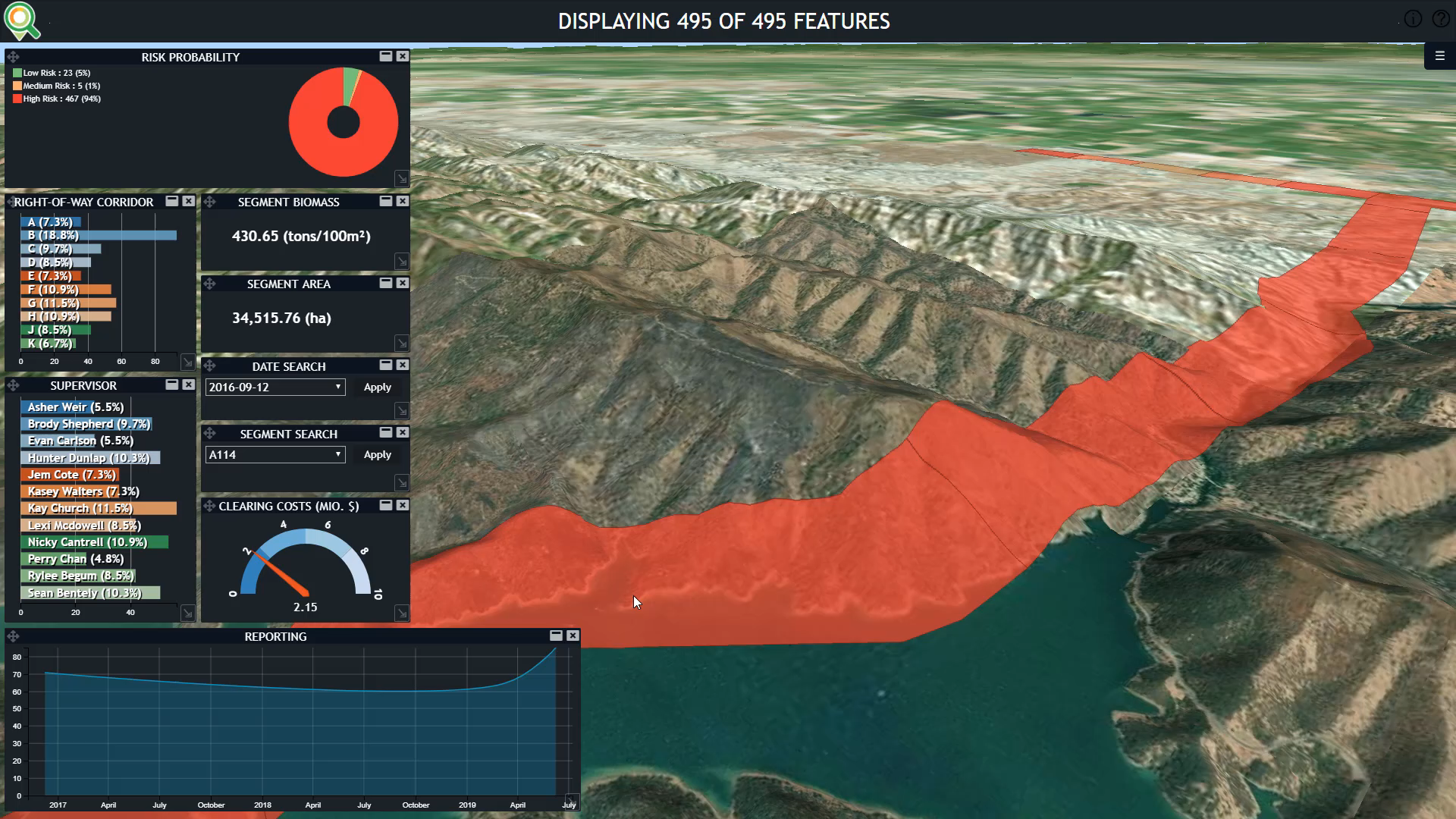
Users can even filter locations based on ecological corridors, which is essential for the conservation of birds and other animal families and to avoid restricted transit areas.
Final Checks Add Cadastral and Environmental Data
Thanks to these AI-powered workflows, it’s possible for users to meet requirements that aim to protect biodiversity (such as guidelines by the World Bank Group).
After land cover and elevation are determined, locations can be checked against cadastral databases and other information sources to ensure their viability and proximity to roads to facilitate transportation.
Other sources of data, such as weather, wind, humidity, and solar impact, can be integrated, too, so officials have as much information as possible. They can then select the location they believe will be the most successful and profitable for any given type of project.
With the remote sensing and Geographic Information Systems operators available in Spatial Modeler, these kinds of analyses are easily scalable. They can even grow into complete applications for use by experts.
Learn more about how the combination of products and solutions in the Hexagon Geospatial division portfolio empower conservationists to better manage the world’s natural resources and work towards sustainability.