


 About the Author: Patrice Lemire About the Author: Patrice Lemire
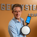
Patrice Lemire is the founder and CEO of Geosystems France. Trained as a hydrographer, he acquired extensive experience in bathymetry, topography, and photogrammetry within the French Navy. He joined Leica Geosystems in 2001 as a Photogrammetry Support Engineer. In 2006, he founded Geosystems France to distribute ERDAS photogrammetry and remote sensing solutions in France and in French-speaking African countries. Patrice is fond of innovation and is pleased to diversify Geosystems France activities’ by developing service-based solutions such as F3D. |
F3D, the comprehensive solution from Hexagon partner GEOSYSTEMS France for the direct georeferencing, surveying, stakeout and verification of open trench networks, is now available on a pole.
Not only does the pole create a more comfortable data collection experience, but it also enables field workers to cover a larger area. The improved portability, combined with technology that allows users to visualize buried networks in augmented reality, is an important innovation.
F3D was built with Hexagon technology including M.App Enterprise and works with the Leica GG04+ GNSS or FLX100 antenna. It also includes augmented reality visualization by vGIS and lets users conduct open trench surveys and create reports fully autonomously — altogether, it’s a powerful and pioneering solution.
Are you ready for the F3D revolution of the utility networks survey revolution with F3D? Watch the videos to see how easily F3D can be implemented.
With F3D on a pole, it’s simple and convenient to georeference an entire street in centimetric accuracy.
With the convenience of a pole, you can survey new utility networks — from georeferencing to drawing a plan — in just a few minutes.
You can even visualize detected utility networks in real time with the augmented reality add-on.
