


Over the past several years, there has been a lot of talk about radar data. New sensors, new programs, new software. But the industry hasn’t seen the explosive use of radar data as projected. Why? In part, this might be because the average geospatial professional – even an astute and learned professional – thinks of radar data as existing exclusively in the domain of research, the military, and radar experts.
For a long time, this has been the case. But recently, the use of radar data has been making the transition from pure research to a more operational focus. With the launch of the new generation of radar sensors like TerraSAR-X, Sentinel, Radarsat-2, Cosmo SkyMed, and a whole host of others, the industry has made great strides in making the data more accessible through user-friendly interfaces and workflows.
And yet, there is still a reluctance to use radar data. I think that a lot of this reluctance stems simply from a misunderstanding of the data. To be sure, radar imagery is not a substitute for optical data; the information it makes available is totally different. There is also some disillusionment because the applications for radar data have been both oversold and undersold, leading to a lot of misunderstanding, disappointment and missed opportunities.
How Has Radar Data Been Oversold?
For years, people have touted radar’s ability for surface penetration. It is true that, under very specific circumstances, the radar beam will penetrate the earth or vegetation for several meters. When this works it is a very powerful capability, but… it only works under very specific circumstances.
I have been asked to search for Genghis Khan’s tomb in the mountains of Mongolia, subterranean chambers in Petra, bin Laden in Afghanistan, land mines all over the world, Attila’s horde in the Danube river, oil pipelines in the Middle east, narco-trafficantes in the jungle and numerous other projects. Some worked; most did not.
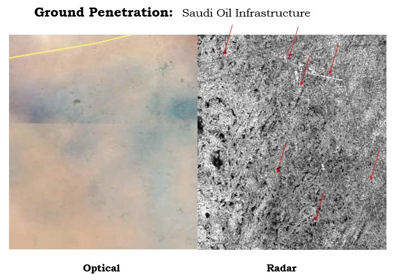
Radar penetration of soil works well in very specific situations, like the sands covering oil infrastructures in Saudi Arabia.
Where Has the Utility of Radar Data Been Undersold?
Conversely, interferometry, or the ability to use radar data to monitor changes in ground deformation, is perhaps undersold. How many people realize that movement at the centimeter level can be easily and routinely detected and mapped? Even with coarse resolution Sentinel-1 data?
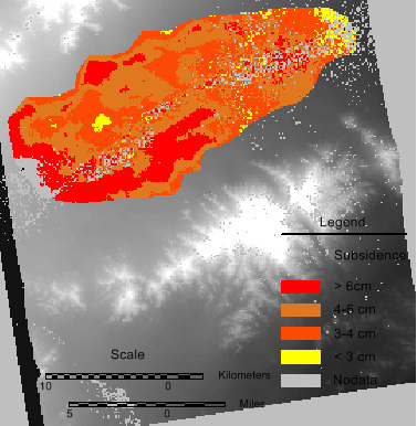
A ground subsidence map derived from radar data.
And I am often told that “radar can’t be used in my area because of vegetation.” Au contraire, I routinely use radar data for vegetation mapping and hope to develop a new tool for ERDAS IMAGINE Radar to automate this process. There is a huge requirement for vegetation mapping worldwide, and radar is definitely part of the solution.
Radar Data is Fundamentally Different
Anyone, everyone, can understand and interpret an optical image. This is because we have all been doing this all of our lives; your eye and brain do it unconsciously. It naturally understands basic image interpretation concepts like shadows or order of sequence (B is behind of A), or that the mountains seem small because they are far away.
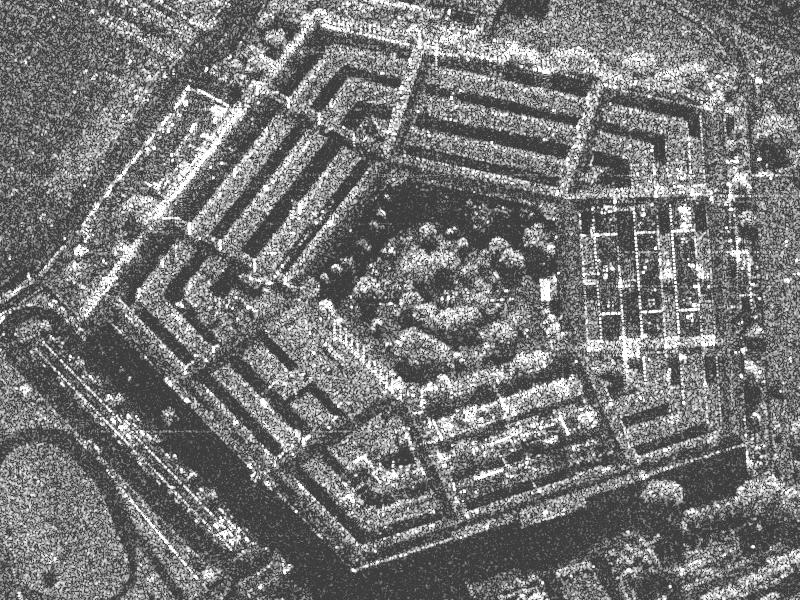
A magnitude layer view of the Pentagon in Washington, DC.
In viewing a radar image (the Magnitude layer), you must actively reject these automatic interpretations and consider non-natural interpretation concepts. You must take into account the nature of the incident radar beam, the direction of its incendence, and radar-target interaction models. Most people don’t do this on a regular basis, so there is a tendency to misinterpret the radar information.
I will talk more about some of the ways that radar data is different in my next blog.
Talkin’ Radar: My Mission
My goal is to discuss these radar imaging, radar phenomenology, and radar data usage issues in a practical context. I want to help you understand what radar data is capable of, and dispel a lot of misunderstanding. Radar data is not magic — but neither is it only for the “radar expert.” With modern radar image processing software, even a novice can extract useful information with little to no understanding of the underlying phenomenology.
As always, the more you know, the better you do your job.
What topics surrounding radar data would you like to hear more about?
