


Rio de Janeiro hosted the XXXI Olympic Games earlier this month. Many speculated about the host city’s preparations, especially in regards to the safety and security of athletes and spectators during their visit. Thankfully, due to the diligence of the authorities, major problems were avoided at the Games. But even a successful Olympic Games doesn’t go off without a hitch.
Early Challenges for the Rio Olympic Games
Prior to the Olympic Games, several incidents occurred which prompted speculation about the security at the Games. In Australia, we were saddened by the news that Australian Paralympian Liesl Tesch and the team physiotherapist Sarah Ross were held at gunpoint by two men and robbed of their bicycles. The incident occurred on the popular Flamengo Beach with several witnesses, none of whom came to their aid. Many news publications across Australia carried this story, fueling the concern for our athletes.
However, it was not an isolated incident. Back in May, three members of the Spanish Olympics sailing team were also robbed at gunpoint while walking through the city. A level of crime was expected, and with reports indicating an upswing, it was unclear how Rio would manage.
Using Incident Analyzer for the Olympic Games
Thankfully, the Brazilian authorities were hard at work monitoring the city and protecting the athletes. To help with this mission, Hexagon Geospatial developed the Incident Analyzer. This Hexagon Smart M.App enables authorities to visualize and analyze reported crimes and other incidents. The web-based application plugs directly into the live systems already in place and translates it into a dashboard view. From the dashboard, authorities see where and when these incidents most often occur.
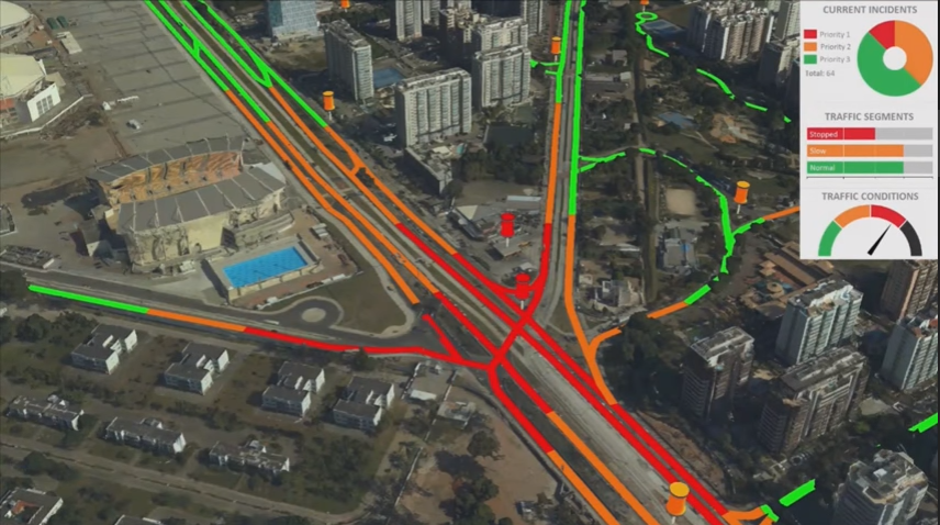
The real power of Incident Analyzer is its ability to quickly segment data. Intuitive widgets help authorities instantly slice the data into types of incidents, areas, and days of the week. This Smart M.App helps authorities effectively prioritize and position their resources throughout the city. For example, if they identify a crime pattern on a specific day or time of day, authorities can reschedule their patrols appropriately. They can also dispatch or reroute resources from low risk, neighboring areas to investigate.
Incident Analyzer presents a comprehensive view of location-based data to help authorities proactively manage emergency plans to improve effectiveness and public safety. Through visualization, better understanding of incident patterns within designated areas can be achieved to predict where problems are likely to occur.
See the Incident Analyzer Smart M.App in action in this short demo.
About the Author:
Goran Jovceski
 Having graduated with a Bachelor of Business Marketing and E-commerce double degree from Victoria University, as well as obtaining a Graduate Certificate in Digital Marketing, his role with us focuses on developing marketing strategies and executing campaigns throughout Asia Pacific both direct to market and through channel partnerships to increase brand share and awareness of our organization. Outside of work, Goran is a bit of a tech geek and has a strong passion for motorsport including karting, Formula 1, NASCAR and WRC.
