Great opportunities are opening up for Italy in the space industry. It is no coincidence that, in the Italian strategy for Smart Specialization, Space is the first and most mature chapter with the catchy title of National Plan for Space Economy. That’s also why geospatial information plays an essential role in decision-making and preparatory processes for national defense and for security policies.
To discuss the importance of geospatial information in the military sector, the Rome Chapter of AFCEA, together with Planetek Italia, will host a workshop “Space and Defense: IMINT and GEOINT for geospatial knowledge” on 8 November, in Rome, Italy.
Planetek Italia, a Premium Partner of Hexagon Geospatial, has been operating in the Space Sector for over twenty years. They have participated in major space programs for Earth observation, as well as several activitie s for the defense and security of the European Union. Technologies developed by Planetek Italia, using Hexagon Geospatial tools, have been used in support of dual space missions, such as COSMO-SkyMed. Specific geospatial applications have been developed to support the Italian Armed Forces with operations, humanitarian efforts, border pretection and international military tasks.
The AFCEA workshop will show how national SMEs can play an important role in the Space Sector, by contributing to the development of more incisive tools for decision support and intelligence departments. Planetek Italia will present an overview of the state-of-the-art technology and applications of geospatial solutions in the military industry, in which they and Hexagon Geospatial succeed in changing the market paradigm, by boosting their international experience and leveraging on their Smart Space Solutions.
The second part of the workshop will be devoted to the presentation of real use cases and new applications. Together with Hexagon Geospatial and European Space Imaging, a leading European provider of very high-resolution imagery solutions, Planetek Italia will present the latest solutions in satellite-based Earth observation for the creation of geospatial knowledge in support of Imagery Intelligence and Geospatial Intelligence.
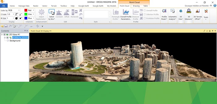
Image Credits – Feature Image, Vricon point cloud of Tripoli, Lybia in ERDAS IMAGINE, courtesy of European Space Imaging


